Community and neighbourhood
Four homes, a small site, close to everything.
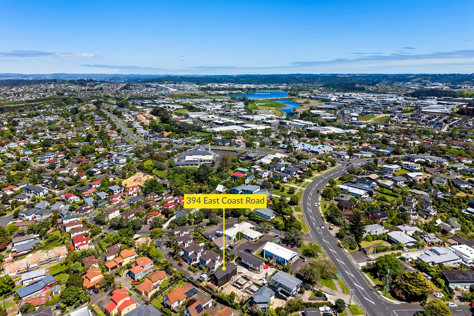
A development of four households in Sunnynook, between the Northern Busway and the East Coast Bays.
- Homes on site
- Four
- Nearest busway stop
- 1.2 km
- School zones
- Three
- City centre
- 12 km
Pictured: Sunnynook from the air, 394 East Coast Road marked
Four homes, small scale, on purpose
This is a development of four households. Small enough that the shared ground works, and small enough that nothing about the build was rushed.
Sunnynook puts the Northern Busway, three school zones and the East Coast Bays within a short distance of the front door, while staying a quiet street to come home to.
What is close by.
Distances are measured from the front door at 394B East Coast Road.
- 0.0 kmTransport
Sunnynook Station, Northern Busway
The Northern Busway has dedicated bus lanes, so the trip south is not held up by general traffic. Sunnynook Station is the nearest busway stop.
- 0 kmSchool zone
Westlake Boys High School
Westlake Boys High School is recorded as a zone for this address. Zones are reviewed and can change.
- 0.0 kmSchool zone
Rangitoto College
Rangitoto College is recorded as a zone for this address. Zones are reviewed and can change.
- 0 kmCoast
East Coast Bays beaches
The beaches of the East Coast Bays run north from Milford, with reserves and coastal walks along the way.
- 0.0 kmSchool zone
Westlake Girls High School
Westlake Girls High School is recorded as a zone for this address. Zones are reviewed and can change.
- 0.0 kmHealth
North Shore Hospital
North Shore Hospital in Takapuna provides the main hospital services for the North Shore.
- 0 kmTown centre
Takapuna
Takapuna is the closest town centre, with the beach, shops and the community services for the area.
- 0 kmCity
Auckland city centre
South over the harbour bridge, or by busway from Sunnynook Station without needing the car.
Distances are approximate, measured from 394B East Coast Road. School zones change, so please check the current zoning with the school or the Ministry of Education.
Come and see how it is built.
Send an enquiry and we will be in touch with viewing arrangements.